The main attractions of Adygea are natural beauty. There are museums and religious sites, but they are just an addition to mountains, waterfalls, lakes and more. Travelers will be able to alternate impressions, getting acquainted with the man-made monuments in between hikes. Many interesting places are concentrated in the Maykop region. The border zone of the republic with the Krasnodar Territory is also rich in picturesque views.
A visit to some corners is no more than an easy walk, while others should be set off only well prepared and better accompanied by a guide. Adygea invites extreme lovers to test themselves by visiting theme parks, or learn more in local reserves. The choice of leisure activities is truly rich.
The most interesting and beautiful places in the region
List, photos with names and descriptions of attractions worth visiting!
Lago-Naki
The plateau is located not only in Adygea, but also captures the territory of the Krasnodar Territory. The height above sea level is 2.2 thousand meters. It is also partially included in the Caucasian reserve since 1992. Alpine meadows are the most famous of the area. One of the most popular ecological hiking trails in the country passes here. Attractions near: Azish Caves.

Mount Fisht
Refers to the territory of both Adygea and Krasnodar Territory. A part of the Main Caucasian ridge with a height of 2.8 thousand meters. One of the most popular stadiums in Russia, located in Sochi and hosting the Olympics, is named in her honor. Several climbing routes of varying difficulty have been laid along the mountain. The coral structure is explained by the fact that in the past, as researchers suggest, Fisht was an island.

Cathedral mosque in Maykop
She began accepting believers in 2000. In addition to direct functions, it is also the seat of the Spiritual Administration of Muslims of the republic and the neighboring Krasnodar Territory. The construction was funded by a sheikh from the UAE, whose mother was a Circassian. The exterior is made of white stone walls, while 5 domes and the tops of 4 minarets are bright blue. Interior decoration - walls inscribed with lines from the Koran.

St. Michael's Athos hermitage
Located in the village of Pobeda, founded in 1877. The monastery flourished and received pilgrims. He had an important shrine - a particle of the Life-giving Cross of the Lord. However, like many others, it was gradually closed after the revolution. In the 2000s, a revival began. Not all buildings and lands were returned to the monastery at once, but this mistake was gradually corrected. At the same time, the local source was re-consecrated.

Rufabgo Falls
Can be found in the Maykop region. They get to them in two ways: by a special tourist bridge (paid), wild (free), but the road is longer and the slope is rather steep. The falls are somewhat spaced apart, some are less noticeable. The highest - "Grandiose" - 829 m above sea level, the lowest - "Three brothers" - 425 m. Attractions nearby: Ancient Circassian gardens and Skvoznaya cave, etc.

Belaya River Canyon (Khadzhokh Gorge)
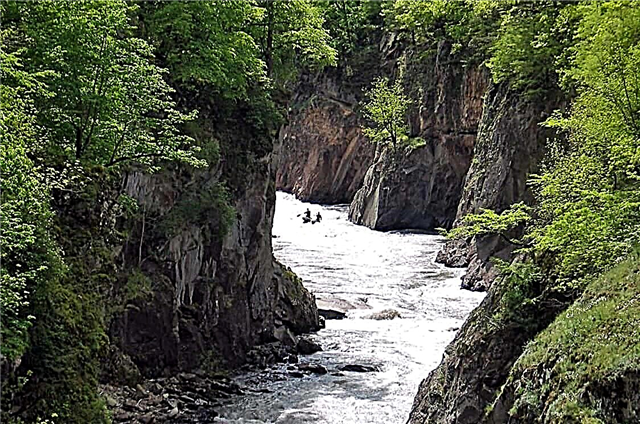
Located near the village of Kamennomostsky. The length of the section is 400 m, the width is about 7 m. A tourist route with paths and railings is equipped in this gorge. The formation of the canyon is associated with the slow dissolution of limestone. On the descent, just below you can look at the enclosures with representatives of the local fauna. Since the end of the 70s of the last century, the gorge has been declared a natural monument.

Caucasian biosphere reserve
It extends over 280 thousand hectares on the territory of Adygea, Karachay-Cherkessia and Krasnodar Territory. It received its current status in 1924. The mixed topography of the surface is rich in mountains and caves. About 1/5 of all plants are rare species. Significant places: a grove with yews that have been growing here for hundreds of thousands of years, and the Laura cordon, where there are many enclosures with deer, bison, foxes and other animals.

Great Azish cave
Located on the border of Adygea and Krasnodar Territory. Opened in 1911, and in 1987 it became a tourist attraction. 220 of 690 m are viewable and well equipped: decks, lights, handrails. There are a lot of stalactites and stalagmites in five halls. They grow into columns and some have separate names. It is a natural monument. The entrance to Malaya Azishinskaya cave is 50 m.

Meshoko gorge
The name translates as "bear valley". Located near the village of Kamennomostsky. The height of the rocks in the gorge reaches 70 m. A special decoration of the area is the grottoes and waterfalls. Cliffs overhang the rocks, making the picture even more picturesque. Traces of ancient fortifications dating from the Bronze Age were found here. There is an abandoned quarry nearby where limestone was mined in the past.

Bogatyr glade
The tract in the Maikop region, which consisted of several hundred dolmens. Most were destroyed, about fifty survived, is located in a group and forms something like an alley. The rest are scattered chaotically throughout the territory. Dolmens are made of slabs and have almost identical dimensions. The name comes from a belief about a people of short people who have incredible heroic strength.

Savranskaya Cable Car
Started its work in 2014. Length - 1.5 km. The ascent is almost 1 km above sea level, and the speed of the trailer is 1.1 m / s. The walk takes place among the greenery. Century pine trees and clean air contribute to the immersion in the atmosphere of the local flavor. Upstairs, you can wander along the Main Caucasian ridge or visit the Grotto of Desires - an unusual through cave.

Rope Adventure Park "Tethys"
A full-fledged complex attraction with several types of programs. When buying a ticket, you can choose one direction or pay for general access. Trolls - descent on a special device at a speed of 50 km / h. Canyoning - descent along the canyon of a mountain river. Climbing the aerial trail is suitable for a rock-climber. There is also an option to ride the highest swing (not for the faint of heart).

Rock fucking finger
Located near the village of Dakhovskaya. Depending on the season chosen, tourists try local nuts, apples and other wild gifts of nature along the way. On the way to the rock, other curious objects come across, such as the Devil's Arch. Right under Devil's Finger, there is a clearing suitable for a picnic. If you move out from the village, then the walking path in one direction is more than 3 hours.

National Museum of the Republic of Adygea
It was opened in the city of Maykop in 1925. The path to a full-fledged museum was long, and in the first years of its existence it was possible to hold on to the enthusiasm of individual people. They collected a rich ethnographic collection, traced in detail the role of the Adygs (Circassians) in the history of the country and preserved many ancient traditions. The exposition consists of costumes, items of folk art and everyday life, as well as archaeological finds.

Dakhovsky bridge
Located in the village of the same name. Built across a mountain river at the very beginning of the 20th century. Its construction was carried out by rebel Cossacks, who were not exiled to Siberia and left in Adygea for heavy work. The bridge was actively used, but it is well preserved. To prevent destruction and preserve an important historical object, a modern structure of concrete and metal was built next to it.

Arboretum in the village of Goncharka
Occupies an area of 150 hectares in the Giaginsky district. It bears the name of the collective farm chairman Bukreev, who initiated the creation of the park in 1970. Initially, only local trees were planted, and then they received seedlings from the Sochi arboretum and began to experiment with exotic things. At the moment, more than 350 species grow side by side. There is a rock garden in the Central Zone.

Maykop city park
Founded in the city center in 1966. It was not looked after for a long time, therefore, at the end of the 2000s, an extensive reconstruction had to be carried out in order to give the resting place a proper look. In addition to new benches, ornamental tiles, snack points and cafes, there are rides, as well as a large outdoor pool, which is recruited in summer. One of the local beauties - "Clock" - a fountain with light and music.

Museum of Nature of the Caucasian Reserve
Located in the village of Guzeripl since 1965. The entrance is paid and first you have to go through the main post of the reserve itself. On the way to it, there are dolmens and a monument to soldiers. The museum is divided into halls. The very first tells about the creation of the reserve. In the following, we are talking about the local flora and fauna: there are stuffed animals, volumetric models, diagrams and small fragments of different natural zones have been recreated.

Mount Big Thach
It is located on the border between the Republic of Adygea and the Krasnodar Territory. The absolute height is more than 2.3 thousand meters. The name translates as “forever young god”. It is part of the natural park of the same name and together with it is included in the UNESCO World Heritage List. The mountain range looks like an uneven jagged wall, the slopes of which are covered with greenery from below, and closer to the tops are bare.

Valley of the ammonites
This natural monument can be examined in detail if you go down to the Belaya River between two villages: Kamennomostsky and Tulsky. Ammonites are fossils left over from ancient molluscs that have become extinct along with dinosaurs. Their spiraling shells of impressive size are scattered all over the place. There are other curly stones that remind: once Adygea was hidden under the waters of the ocean.

Granite gorge
Located near the village of Dakhovskaya. Its length is about 4 km, and its width is about 200 m. There are many attractions in the area, such as the Golden Spring or the Trident Mountain. It is more convenient to inspect the gorge from one of the natural observation platforms. It is especially beautiful here during the flowering period of chestnuts and barberries. In winter, part of the stormy stream freezes, which also looks spectacular.

Cossack stone
It is difficult to pass by this attraction of the village of Kamennomostsky because of its size: when traveling around the district, you will have to go around a stone. The name is explained by one of the legends: the Cossacks moved the rock from its place when the land was divided in order to take more territory for themselves. Another name is Maiden: supposedly a girl, disguised as a horseman, was the only one who could jump on a stone on a horse.

Sahrai waterfalls
There are several of them (Mamryuk, Mankin noise and others), located near the village of Ust-Sukhrai. The most famous of the group is called the Rift. The area around is suitable for gatherings, there are gazebos. In the summer, the ticket office is open, and you will have to pay to see the waterfall nearby, the rest of the time the entrance is free, but the water in the lake formed by the waterfall becomes cold, and you will not be able to swim.

Mount Monk
Belongs to the Maykop district. The height is about 500 m. The summit is flat, which makes the natural object stand out from the general background. There is a spring and grottoes, as well as remains of ancient masonry and dolmens. The outlines of the mountain from a certain angle resemble the face of a wrinkled stern old man, so this name was chosen. Another legend says that this image was carved by a monk, so atonement for his sins.

Rock Split
Location - the village of Khamyshki. The height of the walls is up to 100 m, the width of the fault is from 2 to 8 m. The geological monument can be seen in the middle of the forest. After an earthquake that occurred many years ago, a huge crack passed through the entire rock, and now one of the parts has moved somewhat away from the base and looks like a separate formation. The Bzykha flows below, and waterfalls up to 5 m high formed on it.

Lake Psenodah
Occupies part of the area of the Lago-Naki plateau. The shape resembles a wide smile. The length is about 150 m, and the width is about 70 m. The average depth is less than 1 m, although there is a deep dip closer to the southwestern part. Through the intermediary keys, Psenodah is fed by waters from Fisht. Since 2012, a special security regime has been introduced near the lake in order to prevent travelers from completely ditching the local ecology.

Tsice River Canyon
Most often, travelers build a route from Lake Psenodakh. There are few tourists, as getting to the place is not easy. To look around and take beautiful photos, you will have to move directly along the Tsitsa riverbed. For this reason, it is better to come to the canyon at the end of summer, when the water level drops and it is still warmed up. There are many boulders along the banks, there are grottoes, and a snowfield even partially blocks the current.

Khadzhokh quarry
The site of the former mining of limestone and other rocks near the village of Kamennomostsky. The bottom of the abandoned quarry is covered with shallow springs, which eventually formed Lake Krasnoe. The water is clean and invariably cold. And the specific color is obtained from the rocks and the release of fossils. The traditional Tourist Race is held in the vicinity. The convenient location attracts not only tourists but also locals.

Pshekhsky waterfall
Formed between the mountains Fisht and Pshekha-Su. It divides the outwardly single mountain range into parts, but flows down the rocks covered with moss, without going deep into the fault. Height - more than 160 m. In summer, the flow becomes weaker for objective reasons. A convenient road leads to the waterfall, around which there is a forest belt. There are special tourist routes. Children are often taken on such excursions.

Thermal springs of Adygea
In the republic, they can be found in different places. Tourist complexes offer either to rent apartments nearby for a long time, or to relax at the springs for just a couple of hours. It is believed that there are no thermal springs in Adygea with temperatures below +20 degrees. The most popular are those that belong to the Maikop district. For example, "Aqua-Thermo" or "Water Riviera".


