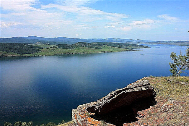
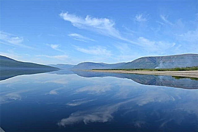
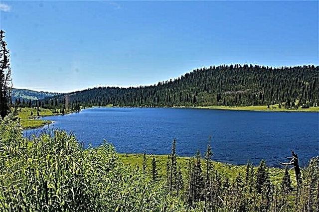
The Krasnoyarsk Territory may surprise those who are accustomed to a typical resort vacation with its natural features. Here contrasting types of terrain and vegetation coexist, and the climate adds color. Numerous lakes are also among the beauties of the region. They are very different in terms of education and size, but each has something to hook the traveler with.
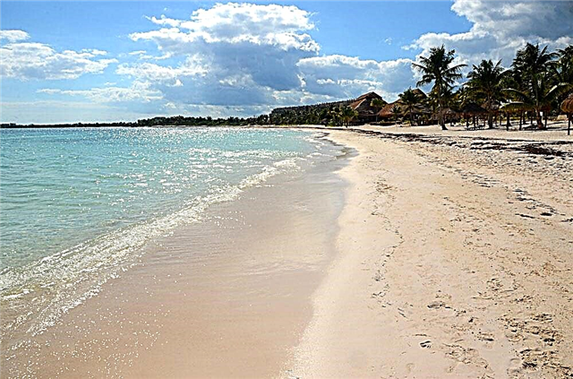
Lake Bolshoye will appeal to beach lovers. Along the way, you can explore the archaeological sites found in its valley. On the bank of Vivi there is a memorial sign marking the geographical center of Russia. You should go to Tagarsky to improve your health, because its water and mud are close in composition to the Dead Sea. Even a small Bartat gives a good impression: there is a wonderful bite here.
The most famous lakes of the Krasnoyarsk Territory
The most popular and beautiful lakes in the region!
Taimyr
It is part of the reserve of the same name. It is the second largest lake in the Asian part of the country. It is also the northernmost of the large ones on the planet. The area is 4560 km², and the depth reaches 26 meters. From September to July, the surface is covered with ice. The water is heated to a maximum of +8 ° C. The temperature regime fully satisfies the needs of 20 species of fish that are found in abundance here. Among them: whitefish, burbot, omul.

Krasnoyarsk sea
The reservoir is called the sea because of its size. The area is 2000 km². The average depth is 37 meters. It was formed on the Yenisei during the construction of a hydroelectric power station. There are several settlements on the coast. Although the Krasnoyarsk Sea is not crossed by bridges, there is a ferry service. When filling the reservoir, unique sights, including the Abakan prison, one of the first Russian settlements in Siberia, went under the water.

Large (Double)
Located in the Sharypovsky district. The area is 34 km². Lake Maloe is just 1.5 km away. The shores contrast with each other: the western one is covered with dense forest, and the eastern one is dominated by the steppe. In the past, the area was sacred to the peoples inhabiting the area. Archaeologists have found sanctuaries and burial mounds related to the Tagar culture. Great for a beach holiday: in summer it quickly warms up to +25 ° C.

Llama
It is surrounded by hills on all sides. The area is 318 km². Depth - up to 600 meters. The water is clean, clear and cold for most of the year. There is a salt layer at the bottom, but the lake remains fresh. Ufologists have chosen the coast and are looking for sources of strength. There is a tourist base, an ethnographic museum is open nearby. River trams run in summer. Through the river of the same name, Lama connects with Lake Melkoe.

Vivi
Located on the territory of the Evenki region. The area is 229 km². The depth of the lake is not precisely measured. According to various estimates, it varies from 80 to 200 meters. 133 rivers flow into Vivi. The region is distinguished by seismic activity, therefore, new cracks periodically appear near the reservoir, and it itself was formed due to a fault in the earth's crust. On the southeastern coast, there is a memorial sign marking the geographical center of Russia.

Uchum
Not just a lake, but a full-fledged balneo-mud resort of the Uzhur region. It was opened in 1925, which makes the resort the first health resort in the region. The dimensions of the reservoir itself are 2 km wide and 4 km long. Mineral and bitter-salty water. Brine and mud are used for medical procedures. The sanatorium specializes in gynecological problems, treatment of the nervous system and digestive organs.

Ingol
They call it "Siberian Ritsa". The area is 4.18 km². The lake is surrounded by mountains and is famous for the transparency of the water, which does not grow cloudy even in the summer. The content of silver in the water is increased, hence the translation of the name - "healthy water". In the northern part of the lake, the Holy Spring gushes. People come here not only for relaxation, but also to improve their health. Bathing in Ingol helps fight rheumatism and inflammatory diseases.

Khantayskoe
It is located in the tundra and forest-tundra region, where permafrost is widespread. The geographical position attracts not only researchers, but also lovers of everything unusual. The area is 822 km². Depth - up to 420 meters. In the south-west of the reservoir there is a large peninsula, and on it there is a village of the same name. Khantayskoe is the mouth of the Khakanchi River. Through a wide and short channel, the lake is also connected with the Small Khantaysky.

Tagarskoe
Located in the Minusinsk Basin. It is elongated in shape and has a length of 3 km. A pine forest rises close to it. In terms of the composition of water and general mineralization, the lake resembles the Dead Sea. Clean air and healing mud attract those who want to recuperate and heal. A sanatorium-preventorium has been operating since 1979, and the first health resorts appeared here in the 1920s.

White
Refers to the Chulym river basin. The name is due to the steel outflow of water. The area is 52.8 km². The lake is regulated, it is freshwater and due to its shallow depth it quickly warms up in the warm months. To the east of Beloye, the state nature reserve "Beryozovaya Dubrava" is organized. Since the hydraulic structures of the area are not in the best condition, there is a threat of flooding of the nearest settlements in a flood.

Round
It is located in the Sharypovsky district. The length is about a kilometer, the width is about 400 meters. Sediments on the bottom are considered curative. The location in the hollow makes the road to Krugloye not so easy. It is best to go hiking or use an SUV. You can set up a camp on the shore at special sites. The lake has other names, for example, Nevestkino. This is due to the legend of the unsuccessful marriage of the Alatau ruler.

Pyasino
Occupies the southwestern part of the North Siberian Lowland. From here to Norilsk about 20 km. The area is 735 km². The average depth is 4 meters. It is covered with ice from October to the end of June. The banks are gently sloping, there are wetlands. However, finding a place to camp is not a problem. Only one river flows out of Pyasino. The reservoir, despite its modest depth, is suitable for small private motor ships.

Borovoe (Plakhino)
A heart-shaped lake can be found in the Aban region. Area - 1.45 km². Plakhino mud is relict: it has been accumulating for thousands of years, therefore it has a unique composition. Silty deposits of this type are called sapropel. They contain the remains of ancient animals and plants. In the medical plan, sapropel helps to fight anemia, lowers blood sugar and stops inflammation.

Essey
Located in the Arctic Circle. The area is 238 km². There is a village of the same name on the shore. The shape of the lake is an oval, its shores are indented by bays and bays. 5 rivers flow in, but only one flows out. Freezing up - from October to June. The place is fishy, but there are difficulties with setting up the camp: you need to know good places or conduct a thorough reconnaissance during the first visit. There are bears and foxes in the forests nearby.

Dupkun
Lies at the bottom of a valley in the southwestern part of the Putorana plateau. The area is 199 km². It has an impressive depth, but no precise measurements have been made. In summer, the water, the mineralization of which is lower than Baikal, warms up to a maximum of +17 ° С. The Kureika River flows through the lake. Not far from the left bank, you can admire the Talnikovy waterfall - the highest in Russia and even in Asia, according to a number of researchers.
Chum
Spreads on the Putorana plateau. Elongated in shape and with an uneven basin. The area is 452 km². The water is clear and does not warm up above +17 ° С. It freezes in October, and ice can lie until July. From the west, the reservoir is limited by hills, and its banks are especially steep. There are about 15 species of fish in Kete. Fishing tours are organized in summer and early autumn. Also here you can meet fans of rafting.

Cheko
The place of the fall of the Tunguska meteorite is located 8 kilometers from the lake. Cheko appeared on maps only in 1929. Its area is 0.25 km², and its depth reaches 50 meters. The Kimchu River flows through the lake. The bottom sediments of the reservoir have been studied for many years. Since legends and beliefs are associated with Cheko, there is no end to expeditions in this area. Both professional scientists from different countries and amateur enthusiasts come.

Oyskoe
It is located in the foothills of the Western Sayan Mountains. Belongs to the territory of the natural park "Ergaki". At a depth of up to 25 meters, the water is so transparent that you can see the bottom even at some distance from the shore. There is snow on the southern side of the lake even in summer. Vegetation around - fir, cedar, juniper. Grayling winters in the waters of Oiskoe. The lake is a natural monument of regional importance since 1985.
Sarbagol
It is separated from the lake by the Big Mountain. Young birches grow around Sarbagol. Special gazebos have been built on the coast. There are also campfire sites. The area is constantly being cleaned. The descent into the water is convenient; wooden steps are built on especially rocky and steep sections. You can have a rest as a savage, or stay at a camp site. There are boats for rent, there is a small cafe and a shop.

Masleevo
Belongs to the Dzerzhinsky district. Surrounded by mixed and pine forests. The area is 1.92 km². It has an oval shape. From the west, the lake is swampy. On the northeastern shore, there is a recreation center converted from a pioneer camp. Special sites and places for setting up tents and making fires have been made. The bite is medium, crucians, perches, roach are caught. Masleevo belongs to the Angara river basin.

Taray
Lake in the southern part of the Krasnoyarsk Territory. The area is 1.5 km², the coastline stretches for 5.5 km. From the northeast, Taray is cut by bays. The maximum depth is about 10 meters. The water is clear, clear and has a bluish tint. The lake's clay is blue and has medicinal properties; it is collected and used for medicinal purposes. The water level has dropped in recent years due to deforestation in the area.

Zolotarnoe
It is located in the Karatuz district in the central part of the Sayan Mountains. The choice of the name is due to the presence of the Golden Key River, which flows through this mountain lake. On the coast, there are boulders, and the coverage of the beaches is mainly rubble. Zolotarnoe is small in area, has an oval shape and is elongated from north to south. Geographically it belongs to the natural park "Ergaki".

Ulukol
Belongs to the reservoirs of the Kansk-Rybinsk depression. The area is less than 4.5 km². The shores are heterogeneous: the forest is replaced by meadows, and those, in turn, are replaced by sand embankments. Ulukol is a fishing place where perch, pike and tench are found. Moreover, in winter there are no fewer people who like to sit with a fishing rod in the district. The bays of the lake are classified as specially protected areas where you can walk, but you cannot make fires or cut trees.

Deep
An alternative name is Omuk-Kyuel. The area is 136 km², the average depth is 16 meters. Formed in a wide basin 65 km from Norilsk. The river of the same name flows out of Glubokoye and carries its waters to Lake Melkoye. The reservoir heats up weakly. The maximum temperature rarely reaches + 10 ° C. Fishing in the season can surprise even experienced anglers with good bite. Grayling, perch, char are found.

Bartat
Locals call it a pond because of its modest size and other features. The best way to get there is along the Yeniseevsky tract. The lake is popular with the nearby fishermen. Small crucian carp bites especially well. Water blooms early, warms up quickly. Cattail covers part of the coastal area. The shore near the water is swampy in places, so you should be careful and use special shoes.

Tsingol
Occupies an area of 1.3 km² in the Sharypovsky district. The phytoplankton of the lake is extremely diverse for such a modest size. There are about 65 species of algae alone. Dirt roads lead to Tsingol. In the past, fry of commercial fish were released into the reservoir and were engaged in their breeding. Now the activity has been curtailed and there are restrictions on the catch: you can not use anything other than a fishing rod.

Kapchuk
Another lake of the Putorana plateau. It is several tens of kilometers from here to Norilsk. The area is 21.2 km². It is of tectonic origin. It is fed by snow and rain, which affects the change in water level from season to season. Vegetation typical of the tundra climate is found along the shores. There are also many hardwoods and shrubs. Through the river of the same name, the Kapchuk is connected with the Lama Lake.

Tailor
The location beyond the Arctic Circle makes the lake special in many ways. The area in different sources is indicated in the range from 360 to 372 km². In especially frosty years, the lake is not completely free of ice. Fish resources are impressive both in diversity and quantity. There are no settlements nearby, but there is an island off the west coast. On it you can watch a large bird colony. Portnyagino belongs to the Laptev Sea basin.

Anama
Lake Evenki region, which is located in the southwest of the Putorana plateau. Area - 58.7 km². One of the tributaries of the Yenisei, the Kureyka River, flows through the Anama. It is fed by snow and rain, so the water level depends directly on precipitation and season. Mineralization is low and transparency is high. Due to the Kureiki waterfalls, the ichthyofauna of the lake is somewhat limited and poorer than in other water bodies of the area.

Monastyrskoe
The lake is located near the city of Yeniseisk. It bears the status of a natural monument of regional significance. The presence of a high iron content in water gives it a reddish tint. It is believed that this feature endows the lake with healing properties. There is a functioning monastery next to the reservoir. There is a playground on the shore where vacationers can put up a car and pitch a tent. The lake is fish, in addition to various types of fish, there is a rare golden crucian carp.